French River Provincial Park
Your first real stop out of Toronto. The French River was the first waterway in Canada designated a Heritage River — walk the 500-foot suspension bridge over the gorge before you're back on the highway.
Free to visitSudbury
Northern Ontario's largest city, and a legitimate stop rather than a gas-and-go. Science North, Dynamic Earth and the Big Nickel anchor a day here, with Lake Laurentian Conservation Area for trails right in town.
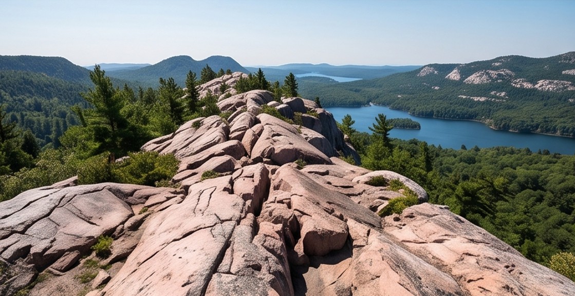
Full day recommendedKillarney Provincial Park
An hour past Sudbury and worth the detour. The "Crack" trail cuts across pink Canadian Shield granite to a panoramic lookout over the La Cloche Hills and Georgian Bay — one of the best day hikes in the province.
Moderate–hard hikeSault Ste. Marie
Your last proper city before the Lake Superior coastline gets remote. Refuel, stock up, and eat well — the drive north from here has long stretches between services.
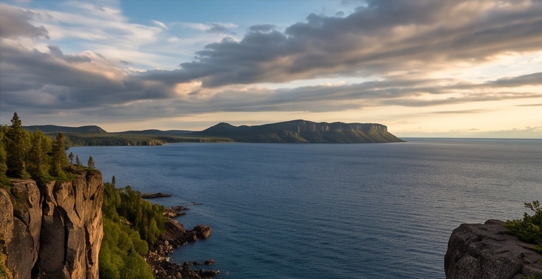
Last major servicesWawa & the Lake Superior Coastline
This stretch is the reason people do this route. Dramatic cliffs, cold-water beaches, and pull-offs at nearly every bend — Pancake Bay and Batchawana Bay make good overnight anchors.
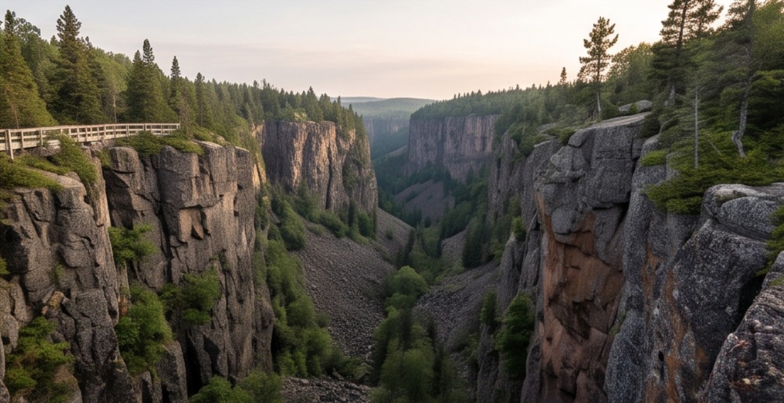
Scenic core of the tripOuimet Canyon Provincial Park
About an hour east of Thunder Bay. A short boardwalk leads to a canyon that plunges roughly 100 metres straight down — one of the most dramatic short stops on the entire route.
30–60 min stopThunder Bay & Sleeping Giant Provincial Park
Journey's end, and worth two or three nights. Walk the waterfront, visit the Terry Fox Monument, and drive the hour out to Sleeping Giant for cliff-top hikes over Lake Superior — a strong base for aurora viewing on a clear night.
2–3 nightsAlong the way
What the Route Actually Looks Like
Not sure how to fit this into your calendar?
The practical side — when to go, what it costs, and how to plan around the 2026 aurora window — is on the next page.